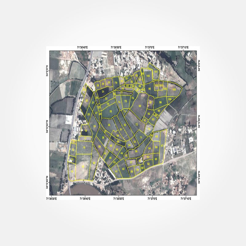
Cadastral Mapping
The cadastral of a country is its register of
property titles. Cadastral mapping is used to track and show the boundary lines
of privately owned real estate and public land. Cadastral GIS data contains
information regarding the legal interpretation of property lines. Through this
information, cadastral maps are created, which may include linework, parcel
number, land ownership, tax and value assessment, dimensions, and topographic
mapping.
Clients and staff may instantly explore, query,
and update data regarding cadastral parcels, which are defined as a continuous
volume of land recognized by a specific set of homogenous property rights, in a
readily accessible repository.
Cadastral systems are frequently used for tasks
like allocating taxes, determining land ownership, supporting land market
values, calculating payments for agricultural subsidies, processing mortgage
applications, and managing forests and vegetation. Cadastral mapping is the
only means of providing accurate, legitimate, comprehensive, precise, and
readily available records of information regarding legal land rights.